Machu Picchu is an incredible mix of history, architecture, and nature. But have you ever wondered how it all comes together? Sitting over 2,400 meters above sea level, this ancient city was both a royal retreat and a center for religious ceremonies. Its design wasn’t random every corner had a specific purpose in mind. Discovered in 1902 by Agustín Lizárraga, a Peruvian farmer and explorer, Machu Picchu initially went unnoticed, even with the government. So, how is the site laid out? With the help of a Machu Picchu map, we will explore its intricate design and understand how the Incas carefully planned it to meet both practical needs and spiritual beliefs.
Where in Peru is Machu Picchu?
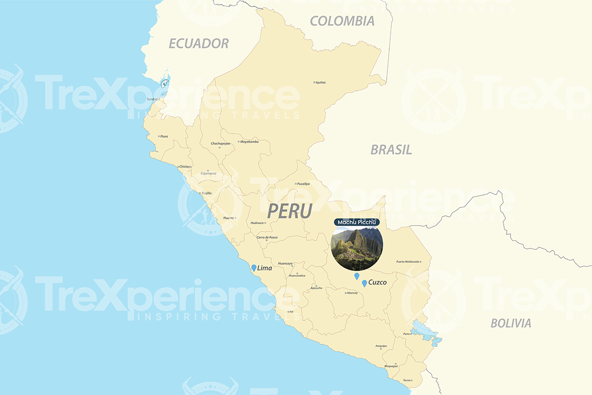
Machu Picchu is located in the Machupicchu District of the Urubamba Province, about 80 kilometers (50 miles) northwest of Cusco City. It sits above the Urubamba River valley, nestled between Machu Picchu Mountain and Huayna Picchu in the Andes. With our Machu Picchu map, we can better understand its unique location within the region.
The Design of Machu Picchu: An Overview
How could the Incas possibly build Machu Picchu in this location? As surprising as it sounds, they did it and even took the luxury of doing it their way.
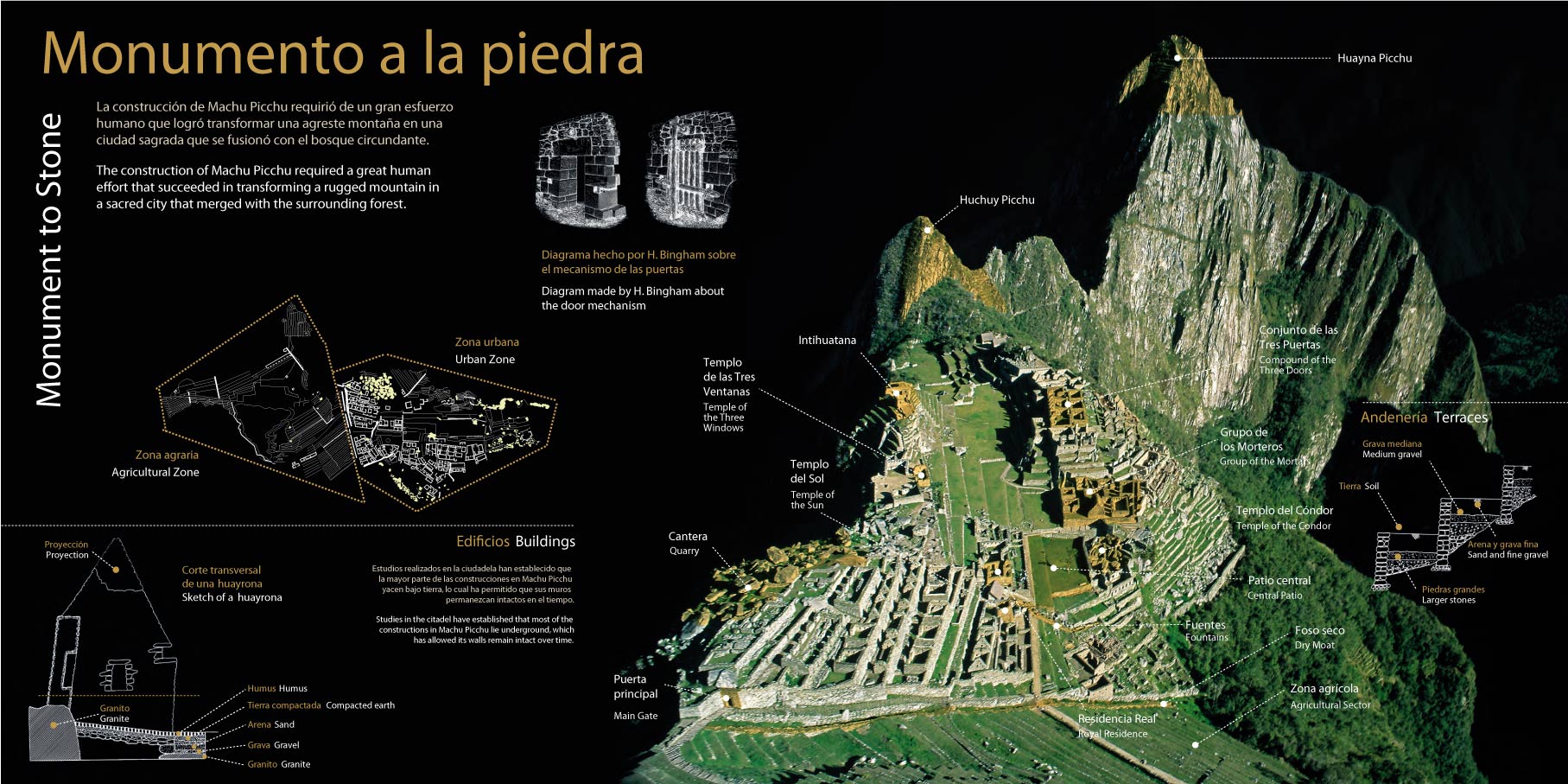
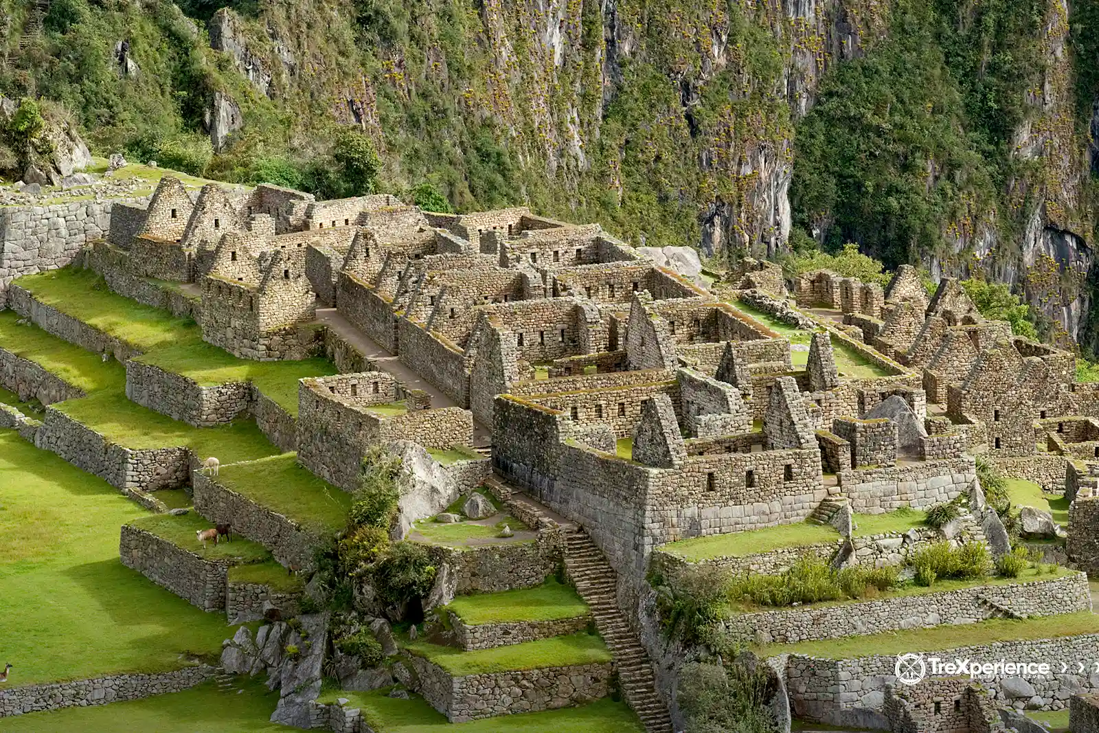
Machu Picchu combines the sacred with the practical. On one side, you'll find different types of buildings, ramps, and stairs; on the other, terraces for intense agricultural activity. The Incas expertly used the natural landscape to their advantage, positioning structures to align with the sun and the surrounding mountains. The whole site was carefully planned to fit perfectly with its surroundings.
To make it clear, we’ll take you through each of these areas that were once part of the “lost city of the Incas” after the Spanish arrived.
Machu Picchu Map: the two main sectors
As we mentioned, Machu Picchu played a key role in the Inca Empire, including strategic and military functions. The site is divided into two main sectors, each with its own purpose. Let’s take a closer look at these areas and their significance within the empire.
Agricultural sector
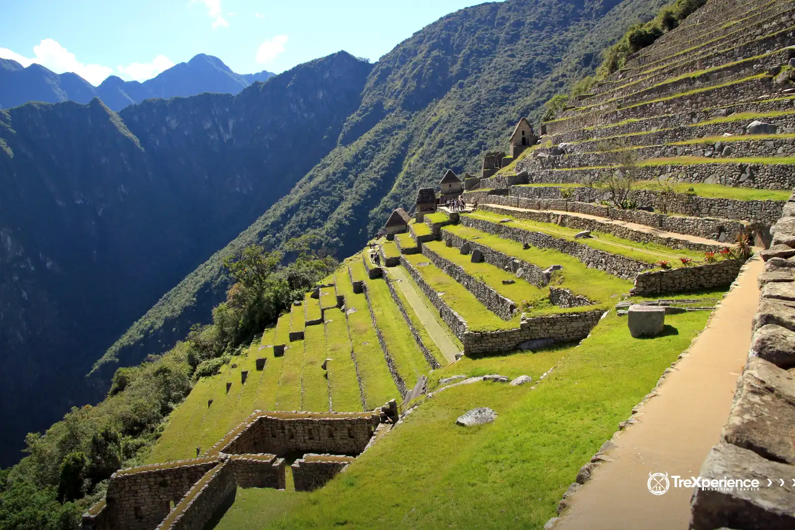
This area is marked by its impressive terraces, designed for cultivation along the slopes of the mountain. Some of these terraces rise over four meters in height and were constructed using a combination of stones of various sizes, fertile soil, and clay.
The terraces were designed to allow easy movement between levels, facilitating access to crops such as corn, which was very important to daily life and the local economy.
Urban sector
This sector, as established by very detailed research, is divided into two:
- Sacred space (Hurin)
- Residential Space (Hanan)
Both areas are clearly defined. The residential sector stands out as being reserved for a dominant and privileged class, including the priestly elite. This is evident in its sophisticated architecture, featuring well-crafted enclosures, passageways, paths, and streets.
Aqueduct system
The Incas developed a complex system of canals and aqueducts to collect and distribute water in Machu Picchu. The aqueducts were built with very precisely carved stones in such a way that they took water from nearby springs and then channeled it to the agricultural terraces and fountains.
In addition to this efficient collection and distribution of water, they had efficient drainage to overcome the rugged terrain and avoid any accumulation that could possibly damage the buildings.
The guard's cabin or guardhouse
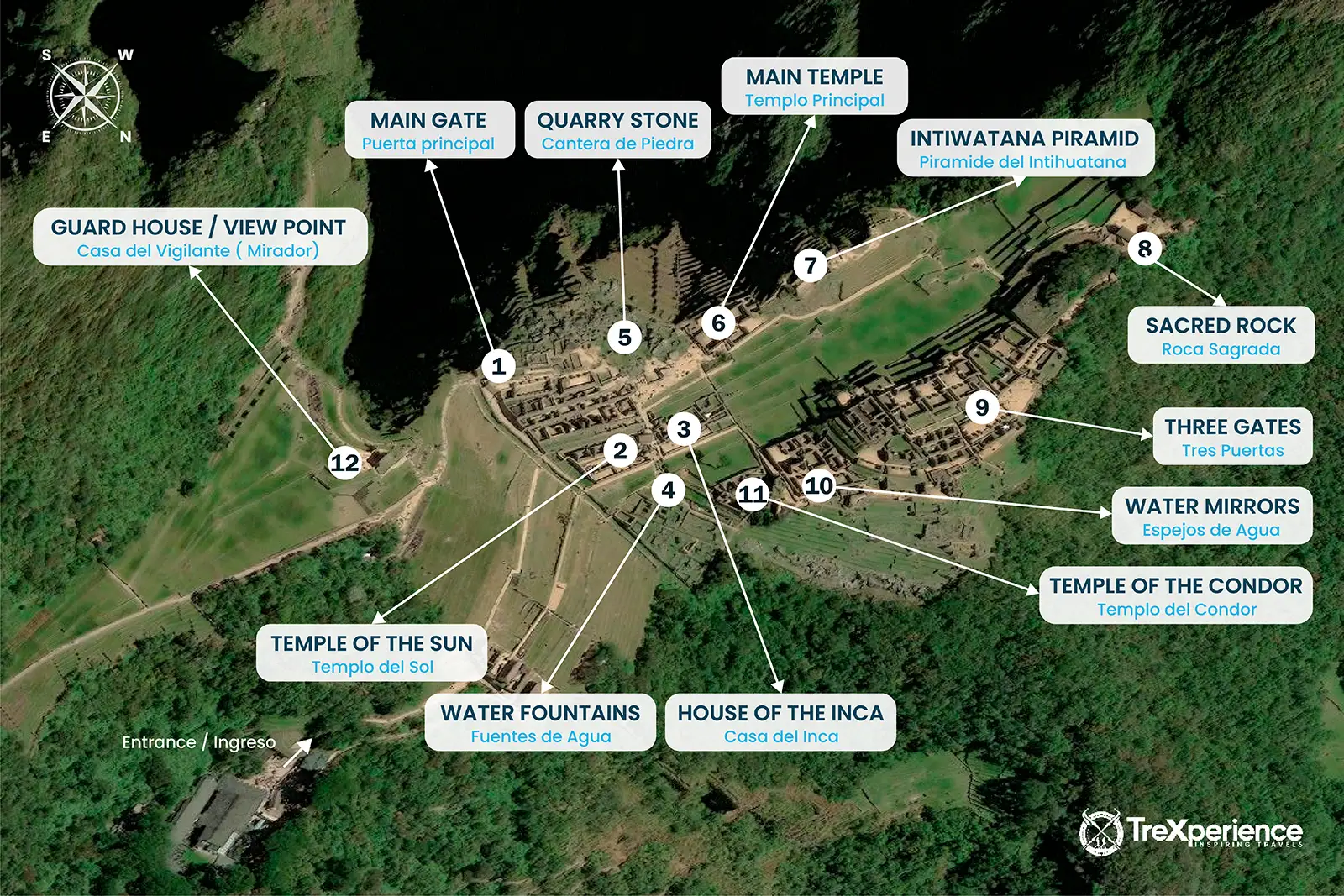
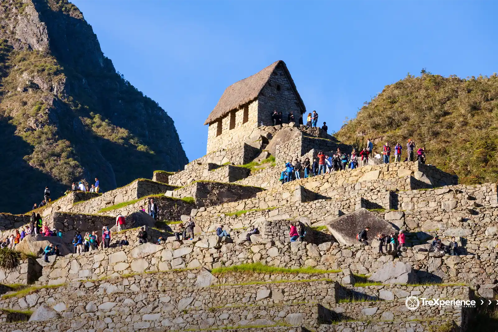
The Guardhouse is located at the highest point of the platforms opposite the cemetery, just behind the Funerary Rock. This small structure, known as a huayrana in Quechua, features three walls with windows on each side, making it an ideal observation point for both the urban and agricultural areas of Machu Picchu.
The urban sector: sacred spaces and daily life
When you stand in Machu Picchu and take it in its entirety, you can imagine life at the height of the Inca Empire. This sector houses the main architectural features of an Inca city (llaqta). To the north lies a large religious area with temples, while to the south are rooms and workshops built on platform terraces.
Picture hierarchs walking through the residential area, priests performing rituals in sacred spaces, and workers carefully tending to the agricultural terraces. For a moment, it’s as if you are transported to the peak of this civilization.
The Temple of the Sun
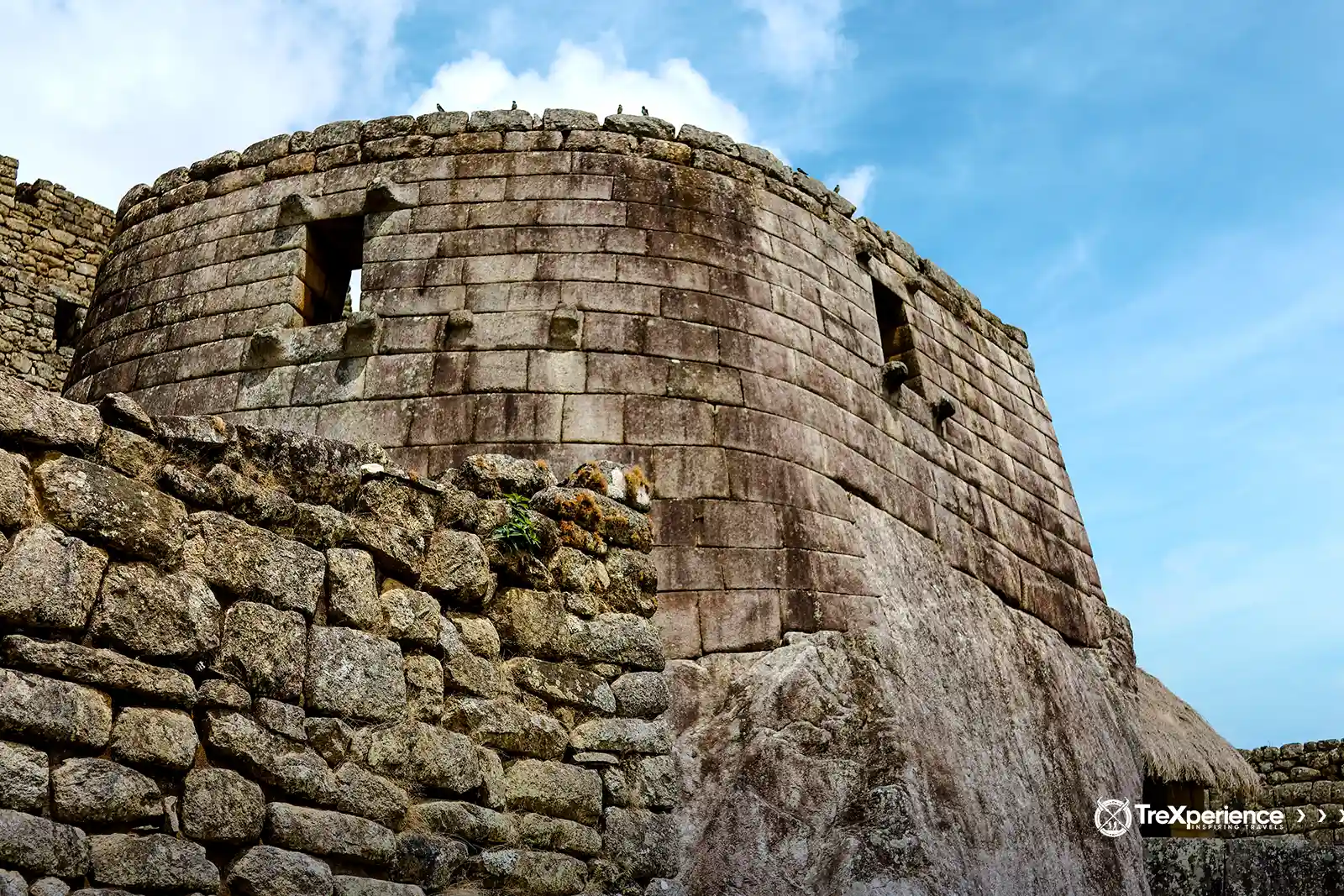
Also known as the Torreón, the name "Temple of the Sun" is more fitting due to its design and intended purposes. One such purpose was as a mausoleum, as it contains arched cavities or niches believed to have held the mummies of important figures.
Religious ceremonies were conducted here, possibly to honor the dead, particularly during the solstices in June and December. These dates were significant for the Incas, who worshipped the sun as the central element of their cosmology. This connection gives the structure its name, emphasizing its role in solar worship and its alignment with key astronomical events.
The Intihuatana Stone
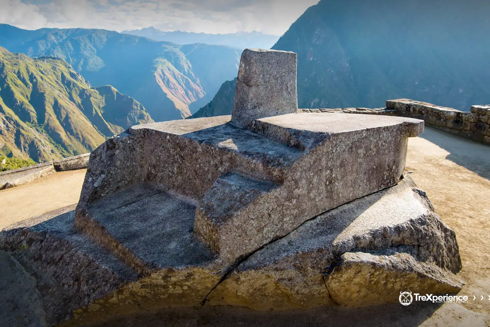
The Intihuatana, meaning "where the sun is tied" in Quechua, is an immense stone structure located in one of the elevated areas of the urban sector. About 1.5 meters tall with a perimeter of nearly 9 meters, its edges are surprisingly aligned with the cardinal points, allowing for accurate tracking of the sun's movements throughout the day and across seasons.
Scholars believe the Intihuatana functioned as an astronomical calendar, helping the Incas mark solstices and adjust their calendar based on the stars. In addition to its practical use, this sundial was very important in religious ceremonies, serving as both a functional tool and a sacred symbol in Inca culture.
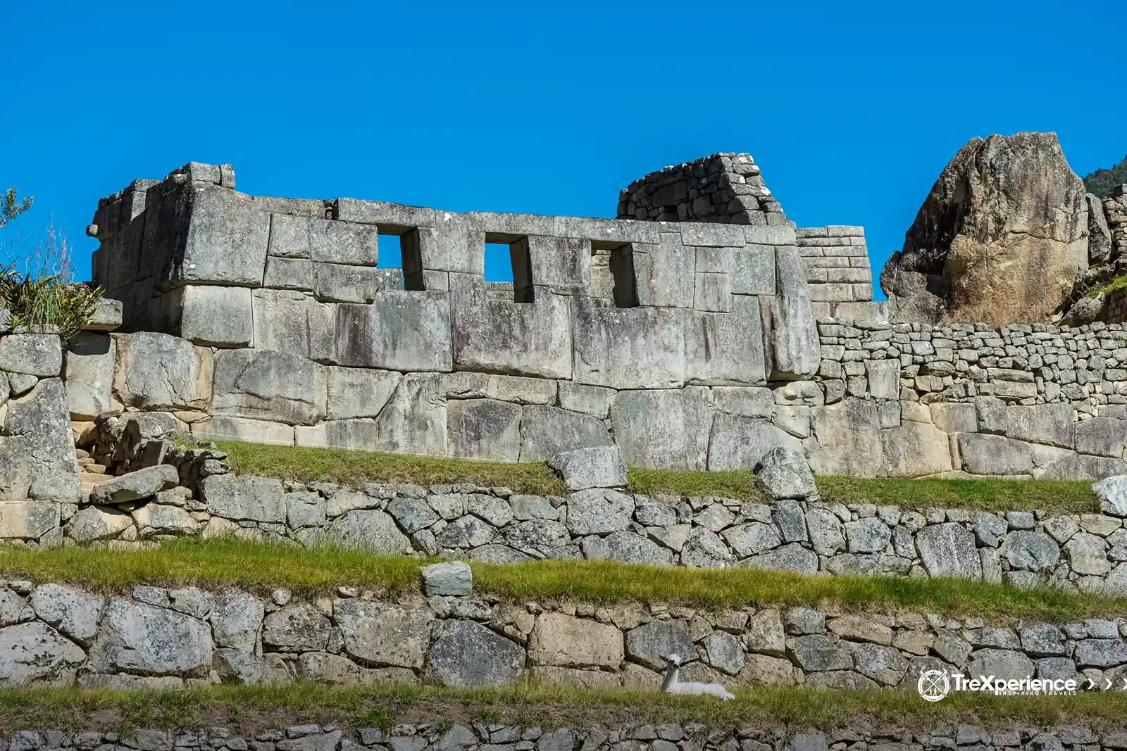
The Hall of the Three Windows
In the northeast of Machu Picchu, next to the Main Temple, you’ll find the Hall or Temple of the Three Windows. This structure consists of three polygonal stone walls assembled with exceptional precision and skill.
The windows were not intended for ventilation but were built for specific ritual purposes tied to Inca traditions. The hall also includes two small niches, one on each side, which are believed to have served similar ceremonial functions as the windows.
The Main Plaza
The Main Plaza, also known as the Sacred Plaza, is a rectangular space of about 400 square meters. It was where the Incas gathered to hold ceremonies honoring their gods, the surrounding mountains, and the sun. It’s flanked by two of Machu Picchu’s most significant religious structures: the Temple of the Three Windows and the Main Temple.
Researchers believe that ordinary people weren’t allowed into the plaza. Access was likely reserved for the elite—high-ranking members of Inca society, making it an exclusive space for important rituals and events.
Residences of Nobles and Commoners
In a society as strictly hierarchical as the Inca Empire, Machu Picchu’s urban area had to have distinct spaces for the elite. The Inca, priests, and their close associates lived in well-built residences designed to suit their high status and provide the necessary comforts.
Workers and townspeople, on the other hand, lived nearby in simpler but sturdy houses. These homes were built to endure harsh weather and ensure that residents could fulfill their responsibilities for both personal and imperial benefit.
The Main Temple
The Main Temple is one of the standout structures at Machu Picchu. Built with massive, carefully carved stone blocks, it follows the huayrana design, which features three solid rectangular walls joined with incredible precision. The craftsmanship demonstrates the Incas' advanced construction techniques.
The central wall towers at an impressive eleven meters. Behind it, you’ll find an enclosure that was likely used for religious purposes. What makes it unique is its 32 angles, creating a striking geometric symmetry that sets it apart from other structures. It’s details like these that make the Main Temple so intriguing.
Huayna Picchu
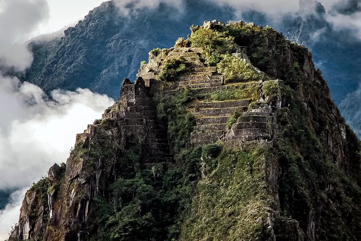
Huayna Picchu, also known as Wayna Picchu, is the iconic mountain that towers over Machu Picchu on the northeast side. The Incas valued it for several reasons: it served as a strategic observation point for spotting potential threats, a site for important rituals, and even a place where they built terraces to grow crops.
Today, it’s famous for its breathtaking views and as a must-do hiking destination. You can trek to the top to explore ruins hidden in the clouds. The hike takes about 1–2 hours and includes climbing the thrilling (and a bit intimidating) "Stairs of Death."
›› Read More: Huayna Picchu Mountain Guide.
Navigating through Machu Picchu
"Navigation" is the perfect way to describe exploring Machu Picchu, but it’s not as simple as just wandering around. The site has strict rules, so planning ahead is key to making the most of your visit.
First, decide how you want to get there. Starting from Cusco, you can take the classic train, hike a scenic trail, or combine both. The choice is yours, but what matters is making that first step toward visiting this incredible place.
After that, you’ll need to choose a circuit based on what you want to explore. Here’s a quick breakdown to help you decide:
- Circuit 1: Takes you to the upper area, including the observatories with panoramic views.
- Circuit 2: Covers most of the site, including the urban area and main landmarks.
- Circuit 3: Focuses on the lower section, including the agricultural terraces and some lesser-visited areas.
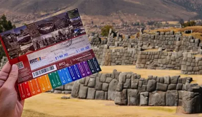
With your ticket and once in Machu Picchu, you can finally explore what this city has to offer.
If you're not sure which circuit you should choose, check out our complete Machu Picchu Tickets Guide.
How to get to Machu Picchu from Aguas Calientes
1. By Bus
2. Hiking
How to get to Machu Picchu from Cusco
Inca Trail to Machu Picchu
Frequently asked questions about the Map of Machu Picchu
Can you enter with a drone to make your own aerial map?
No, the use of drones is prohibited inside Machu Picchu. This is because they can disturb the wildlife, damage structures in case of accidents, and cause inconvenience to other visitors.
How long does it take to tour everything shown on the full map?
It depends on the chosen circuit. A standard tour takes between 2 and 4 hours, but if you decide to include Huayna Picchu or Machu Picchu Mountain, you should add 2 or 3 more hours.
Does the Machu Picchu map change over time?
Yes, the maps are updated periodically because the authorities adjust the circuits to preserve the heritage.
Do the maps show the bathrooms and services inside Machu Picchu?
No. The bathrooms are located outside the main entrance and not inside the citadel. For this reason, it is recommended to use them before entering, since it is not allowed to leave and re-enter the site with the same ticket.
Can I download a Machu Picchu map to my cell phone?
Yes. There are PDF versions on the official website and mobile applications that include interactive maps with photos, descriptions, and circuits.
What is the highest point marked on the Machu Picchu map?
The highest point within the citadel is the Guardian’s House, from where you can get the famous panoramic view.
Is the Machu Picchu map available in several languages?
Yes, printed maps are usually in Spanish and English, but there are also digital versions in French, German, Japanese, and other languages, depending on the tourist service you hire.
Can you tour Machu Picchu without a map?
Yes, but it is not recommended. Although the site has signs, the map helps you locate sectors, temples, and circuits more clearly.
With this Machu Picchu map, you’re already on your way to planning a journey. Machu Picchu is a place where the mystical, spiritual, historical, and cultural all converge, offering a unique perspective on the heritage of South America. Machu Picchu offers not only a deep connection to nature but also a glimpse into the remarkable civilization that once thrived here.
Get ready to immerse yourself in an experience that will leave a lasting impression!




Add new comment