Machu Picchu es una increíble mezcla de historia, arquitectura y naturaleza. Pero, ¿alguna vez te has preguntado cómo se combina todo esto? Situada a más de 2400 metros sobre el nivel del mar, esta antigua ciudad era tanto un refugio real como un centro para ceremonias religiosas.
Su diseño no fue aleatorio: cada rincón tenía un propósito específico. Descubierta en 1902 por Agustín Lizárraga, un agricultor y explorador peruano, Machu Picchu pasó inicialmente desapercibida, incluso para el gobierno. Entonces, ¿Cómo está distribuido el sitio? Con la ayuda de un mapa de Machu Picchu, exploraremos su intrincado diseño y comprenderemos cómo los incas lo planearon cuidadosamente para satisfacer tanto las necesidades prácticas como las creencias espirituales.
¿En qué parte de Perú se encuentra Machu Picchu?
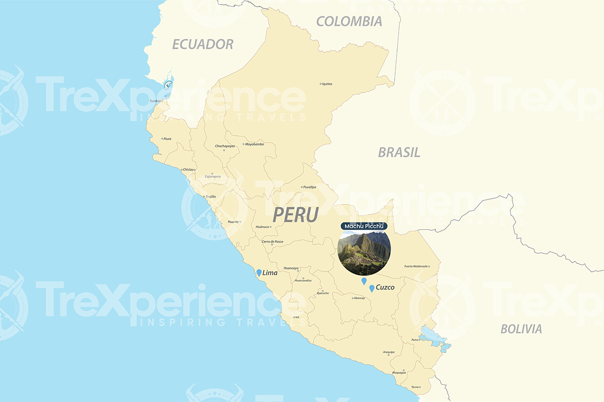
Machu Picchu se encuentra en el Distrito de Machu Picchu de la Provincia de Urubamba, a unos 80 kilómetros (50 millas) al noroeste de la Ciudad del Cusco. Se asienta sobre el valle del río Urubamba, enclavado entre la montaña Machu Picchu y el Huayna Picchu en los Andes. Con nuestro mapa de Machu Picchu, podemos entender mejor su ubicación única dentro de la región.
El diseño de Machu Picchu: una visión general
¿Cómo pudieron los incas construir Machu Picchu en este lugar? Por sorprendente que parezca, lo hicieron e incluso se dieron el lujo de hacerlo a su manera.
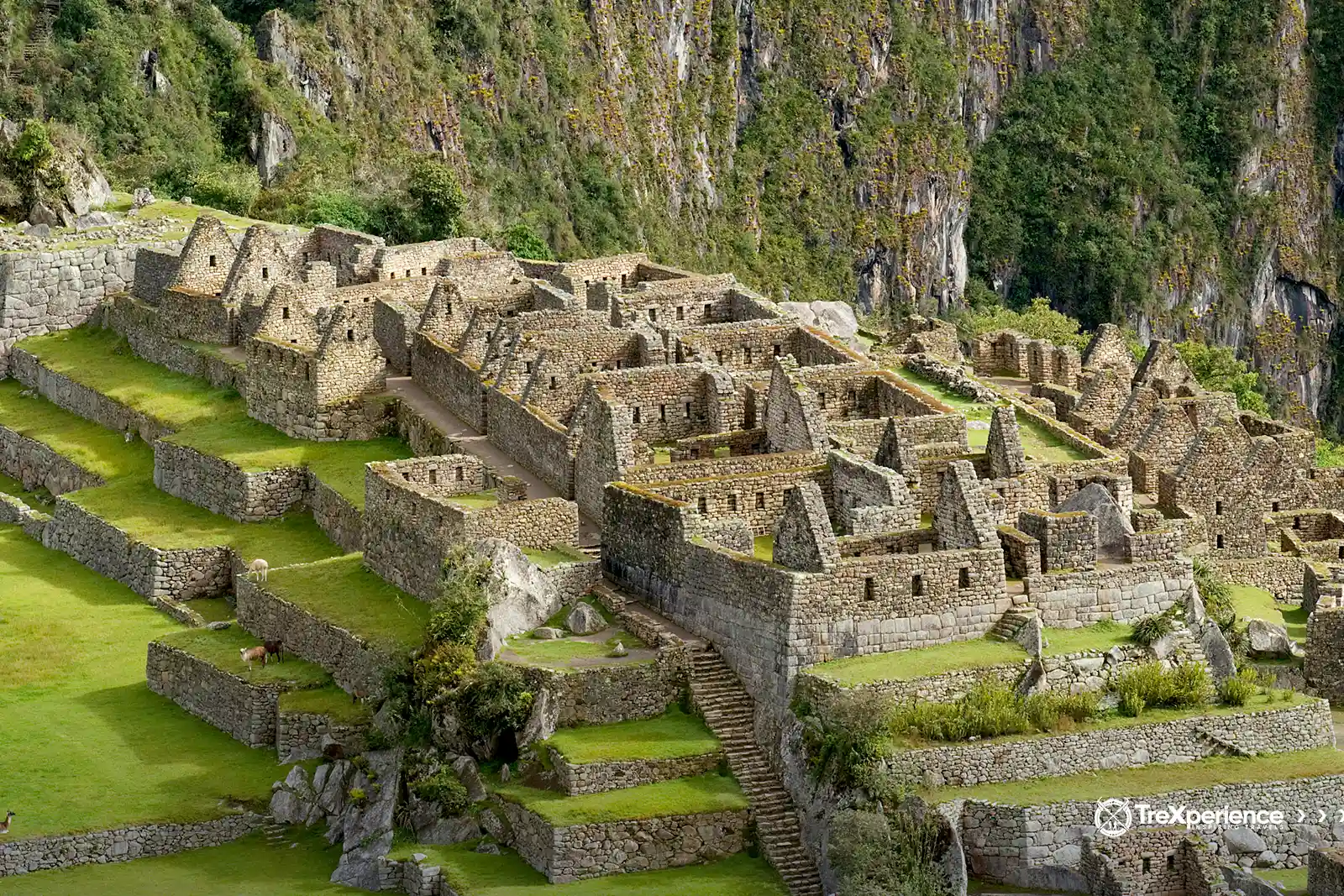
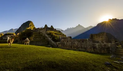
Machu Picchu combina lo sagrado con lo práctico. En un lado, encontrarás diferentes tipos de edificaciones, rampas y escaleras; en el otro, terrazas para una intensa actividad agrícola. Los incas usaron magistralmente el paisaje natural a su favor, posicionando estructuras para alinearlas con el sol y las montañas circundantes. Todo el sitio fue cuidadosamente planificado para encajar perfectamente con su entorno.
Para que quede claro, te llevaremos a través de cada una de estas áreas que alguna vez formaron parte de la “ciudad perdida de los incas” después de la llegada de los españoles.
Mapa de Machu Picchu: los dos sectores principales
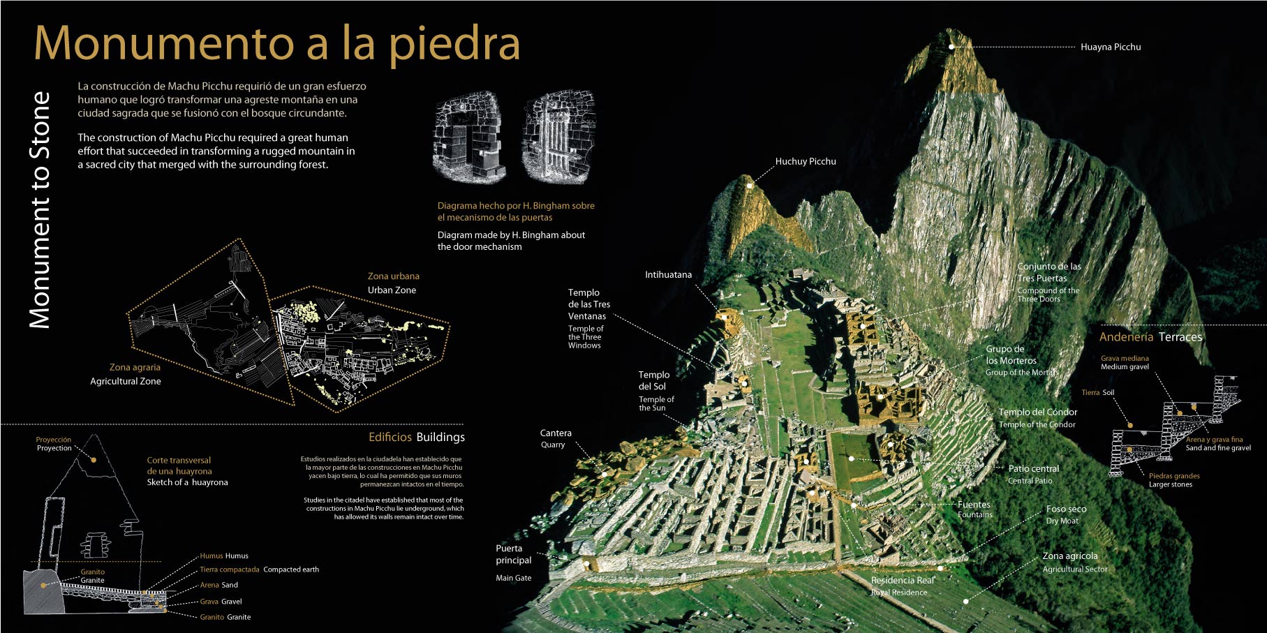
Como mencionamos, Machu Picchu jugó un papel clave en el Imperio inca, incluyendo funciones estratégicas y militares. El sitio está dividido en dos sectores principales, cada uno con su propio propósito. Veamos más de cerca estas áreas y su importancia dentro del imperio.
Sector agrícola
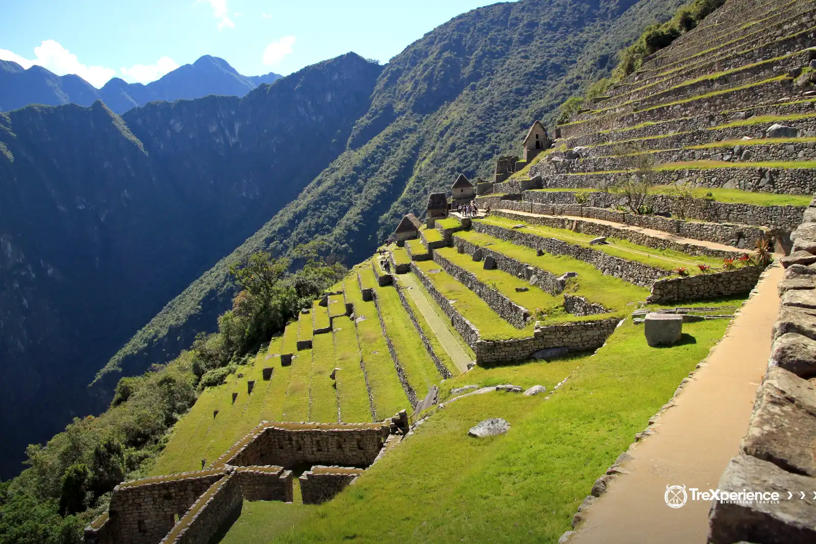
Esta área se caracteriza por sus impresionantes terrazas, diseñadas para el cultivo a lo largo de las laderas de la montaña. Algunas de estas terrazas superan los cuatro metros de altura y fueron construidas con una combinación de piedras de varios tamaños, tierra fértil y arcilla.
Las terrazas fueron diseñadas para permitir un fácil desplazamiento entre niveles, facilitando el acceso a cultivos como el maíz, que era muy importante para la vida diaria y la economía local.
Sector urbano
Este sector, según investigaciones muy detalladas, se divide en dos:
- Espacio sagrado (Hurin)
- Espacio residencial (Hanan)
Ambas áreas están claramente definidas. El sector residencial destaca por estar reservado a una clase dominante y privilegiada, incluyendo la élite sacerdotal. Esto se evidencia en su arquitectura sofisticada, con recintos bien elaborados, pasajes, caminos y calles.
Sistema de acueductos
Los incas desarrollaron un complejo sistema de canales y acueductos para recolectar y distribuir agua en Machu Picchu. Los acueductos fueron construidos con piedras talladas con gran precisión, de tal forma que tomaban agua de manantiales cercanos y luego la canalizaban hacia las terrazas agrícolas y fuentes.
Además de esta eficiente recolección y distribución de agua, contaban con un drenaje eficaz para superar el terreno accidentado y evitar cualquier acumulación que pudiera dañar las edificaciones.
La cabaña del guardián o casa de vigilancia
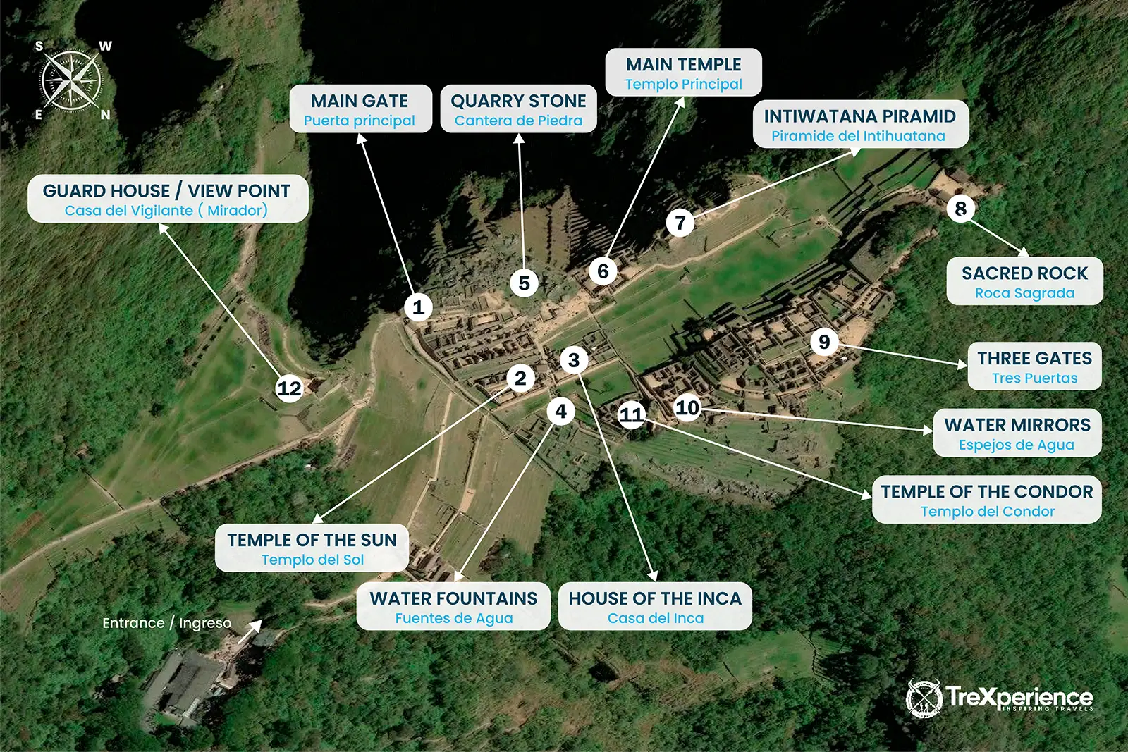
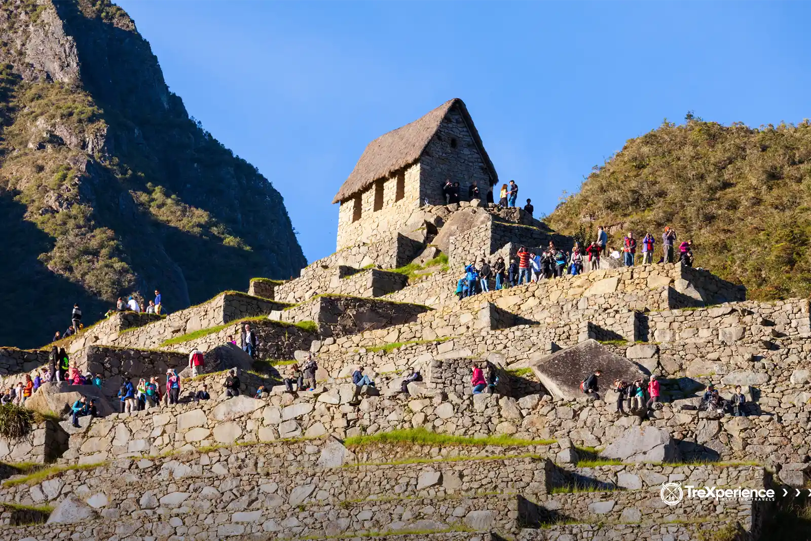
La Casa del Guardián se encuentra en el punto más alto de las plataformas frente al cementerio, justo detrás de la Roca Funeraria. Esta pequeña estructura, conocida como huayrana en quechua, presenta tres muros con ventanas a cada lado, lo que la convierte en un punto de observación ideal tanto del área urbana como del agrícola de Machu Picchu.
El sector urbano: espacios sagrados y vida cotidiana
Cuando te paras en Machu Picchu y lo observas en su totalidad, puedes imaginar la vida en la cima del Imperio inca. Este sector alberga las principales características arquitectónicas de una ciudad inca (llaqta). Al norte se encuentra una gran área religiosa con templos, mientras que al sur hay habitaciones y talleres construidos sobre terrazas.
Imagina a los jerarcas caminando por el área residencial, sacerdotes realizando rituales en espacios sagrados y trabajadores cuidando con esmero las terrazas agrícolas. Por un momento, es como si fueras transportado a la cúspide de esta civilización.
El Templo del Sol
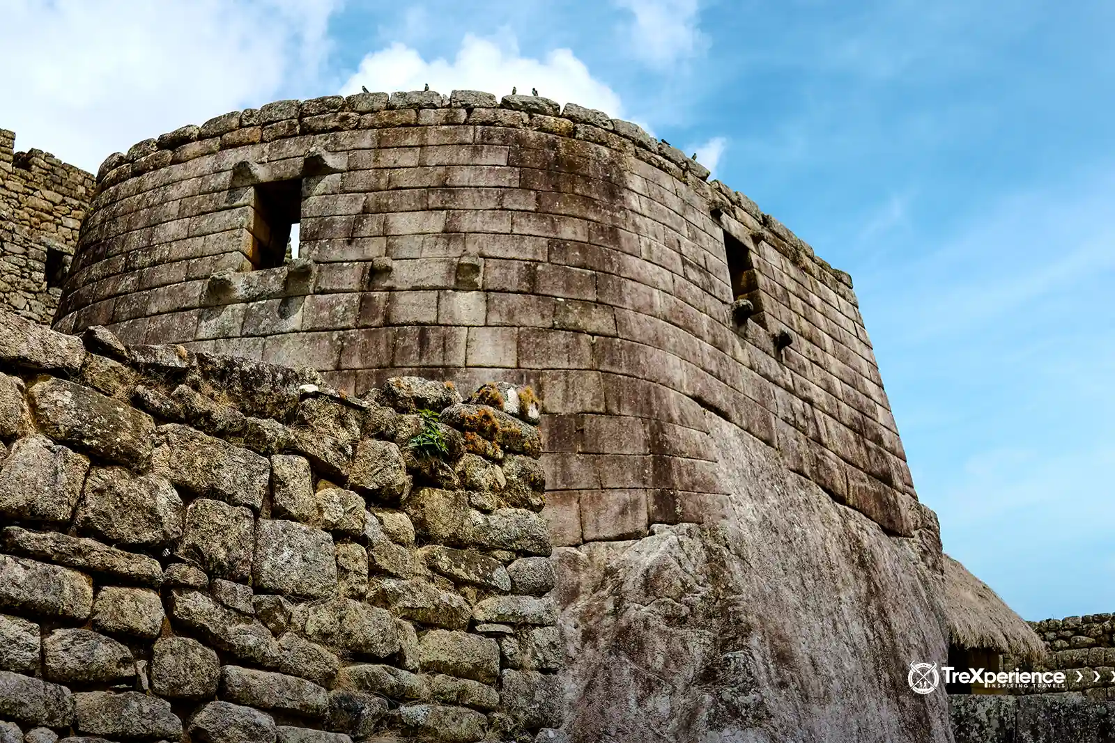
También conocido como el Torreón, el nombre de "Templo del Sol" es más apropiado debido a su diseño y fines previstos. Uno de esos fines era el de mausoleo, ya que contiene cavidades o nichos arqueados que se cree que albergaban las momias de personajes importantes.
Aquí se realizaban ceremonias religiosas, posiblemente para honrar a los muertos, especialmente durante los solsticios de junio y diciembre. Estas fechas eran significativas para los incas, quienes adoraban al sol como el elemento central de su cosmovisión. Esta conexión le da al templo su nombre, enfatizando su papel en el culto solar y su alineación con eventos astronómicos clave.
La Piedra Intihuatana
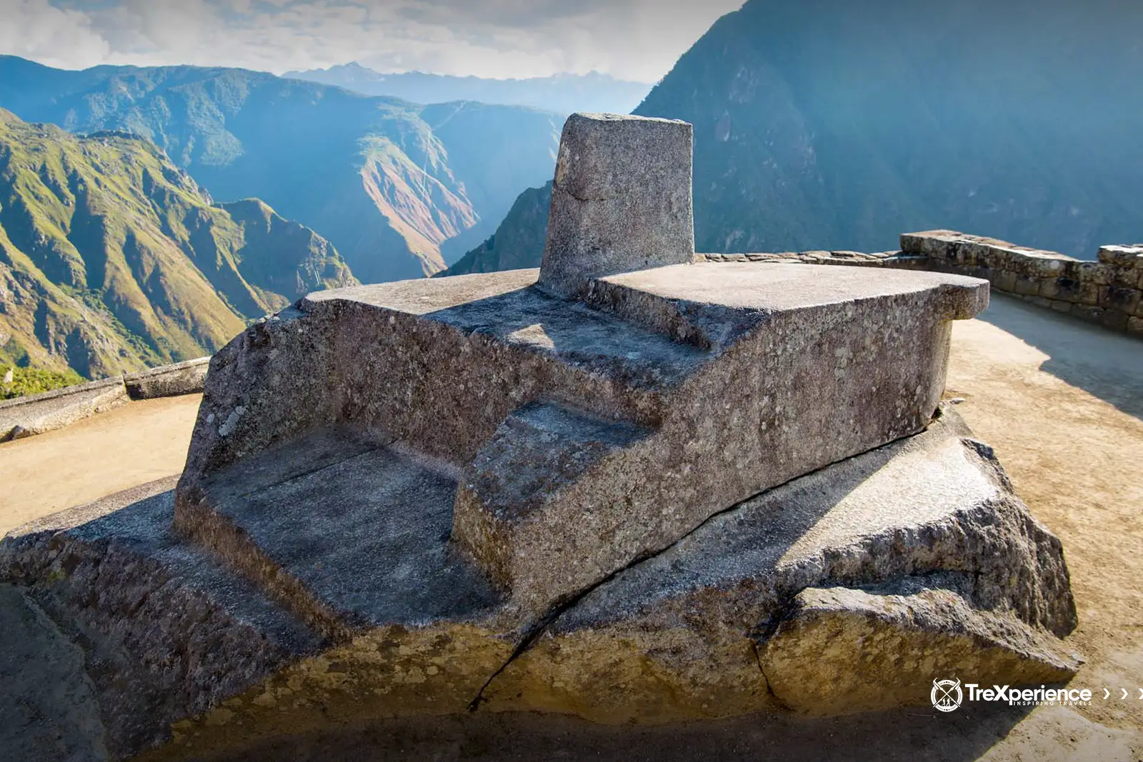
El Intihuatana, que significa "donde se amarra el sol" en quechua, es una inmensa estructura lítica ubicada en una de las áreas elevadas del sector urbano. Con aproximadamente 1,5 metros de altura y un perímetro cercano a los 9 metros, sus bordes están sorprendentemente alineados con los puntos cardinales, lo que permitía un seguimiento preciso de los movimientos del sol a lo largo del día y las estaciones.
Los estudiosos creen que el Intihuatana funcionaba como un calendario astronómico, ayudando a los incas a marcar los solsticios y ajustar su calendario en función de las estrellas. Además de su uso práctico, este reloj solar era muy importante en ceremonias religiosas, sirviendo tanto como herramienta funcional como símbolo sagrado en la cultura inca.
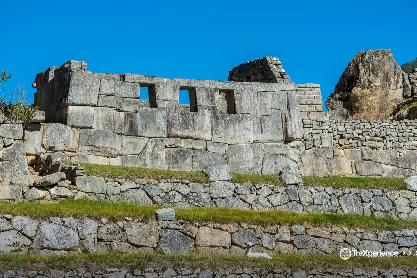
El Templo de las Tres Ventanas
En el noreste de Machu Picchu, junto al Templo Principal, encontrarás la Sala o Templo de las Tres Ventanas. Esta estructura consta de tres muros poligonales de piedra ensamblados con excepcional precisión y destreza.
Las ventanas no estaban destinadas a la ventilación, sino que fueron construidas con fines rituales específicos ligados a las tradiciones incas. La sala también incluye dos pequeños nichos, uno a cada lado, que se cree cumplieron funciones ceremoniales similares a las ventanas.
La Plaza Principal
La Plaza Principal, también conocida como la Plaza Sagrada, es un espacio rectangular de unos 400 metros cuadrados. Era el lugar donde los incas se reunían para realizar ceremonias en honor a sus dioses, a las montañas circundantes y al sol. Está flanqueada por dos de las estructuras religiosas más importantes de Machu Picchu: el Templo de las Tres Ventanas y el Templo Principal.
Los investigadores creen que la gente común no podía ingresar a la plaza. El acceso probablemente estaba reservado a la élite: los miembros de alto rango de la sociedad inca, convirtiéndola en un espacio exclusivo para rituales y eventos importantes.
Residencias de nobles y plebeyos
En una sociedad tan estrictamente jerárquica como la del Imperio inca, el área urbana de Machu Picchu debía contar con espacios distintos para la élite. El Inca, los sacerdotes y sus allegados vivían en residencias bien construidas diseñadas para adaptarse a su alto estatus y brindarles las comodidades necesarias.
Los trabajadores y pobladores, en cambio, vivían cerca en casas más simples pero resistentes. Estas viviendas fueron construidas para soportar el clima riguroso y asegurar que los habitantes pudieran cumplir sus responsabilidades tanto personales como en beneficio del imperio.
El Templo Principal
El Templo Principal es una de las estructuras más destacadas de Machu Picchu. Construido con enormes bloques de piedra cuidadosamente tallados, sigue el diseño huayrana, que presenta tres sólidos muros rectangulares unidos con increíble precisión. La artesanía demuestra las avanzadas técnicas constructivas de los incas.
El muro central se eleva a unos impresionantes once metros. Detrás de él, encontrarás un recinto que probablemente se usaba con fines religiosos. Lo que lo hace único son sus 32 ángulos, creando una sorprendente simetría geométrica que lo distingue de otras estructuras. Son detalles como estos los que hacen al Templo Principal tan fascinante.
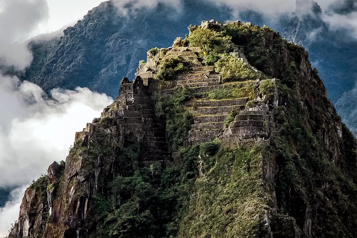
Huayna Picchu
Huayna Picchu, también conocido como Wayna Picchu, es la icónica montaña que se eleva sobre Machu Picchu en el lado noreste. Los incas lo valoraban por varias razones: servía como punto estratégico de observación para detectar posibles amenazas, lugar para rituales importantes e incluso espacio donde construyeron terrazas para cultivar.
Hoy es famoso por sus impresionantes vistas y como destino de senderismo imperdible. Puedes subir hasta la cima para explorar ruinas ocultas entre las nubes. La caminata toma entre 1 y 2 horas e incluye el ascenso por las emocionantes (y algo intimidantes) "Escaleras de la Muerte".
›› Leer más: Guía de la Montaña Huayna Picchu.
Navegando por Machu Picchu
"Navegar" es la forma perfecta de describir explorar Machu Picchu, pero no es tan simple como deambular por ahí. El sitio tiene reglas estrictas, por lo que planificar con anticipación es clave para aprovechar al máximo tu visita.
Primero, decide cómo quieres llegar. Partiendo desde Cusco, puedes tomar el tren clásico, caminar por un sendero escénico o combinar ambos. La elección es tuya, pero lo que importa es dar ese primer paso hacia visitar este lugar increíble.
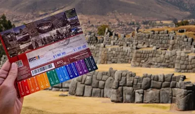
Después de eso, deberás elegir un circuito en función de lo que quieras explorar. Aquí tienes un breve desglose para ayudarte a decidir:
- Circuito 1: Te lleva a la zona alta, incluyendo los observatorios con vistas panorámicas.
- Circuito 2: Cubre la mayor parte del sitio, incluyendo el área urbana y los principales monumentos.
- Circuito 3: Se centra en la sección baja, incluyendo las terrazas agrícolas y algunas zonas menos visitadas.
Con tu entrada y una vez en Machu Picchu, finalmente podrás explorar lo que esta ciudad tiene para ofrecer.
Si no estás seguro de qué circuito elegir, consulta nuestra completa Guía de Entradas a Machu Picchu.
Cómo llegar a Machu Picchu desde Aguas Calientes
1. En bus
2. Caminando
Cómo llegar a Machu Picchu desde Cusco
Camino Inca a Machu Picchu
Preguntas Frecuentes sombre el Mapa de Machu Picchu
¿Se puede ingresar con un dron para hacer tu propio mapa aéreo?
No, el uso de drones está prohibido dentro de Machu Picchu. Esto se debe a que pueden alterar la fauna, dañar estructuras en caso de accidentes y generar molestias a otros visitantes.
¿Cuánto tiempo toma recorrer lo que aparece en el mapa completo?
Depende del circuito elegido. Un recorrido estándar toma entre 2 y 4 horas, pero si decides incluir Huayna Picchu o Montaña Machu Picchu, deberás añadir 2 o 3 horas más.
¿El mapa de Machu Picchu cambia con el tiempo?
Sí, los mapas se actualizan periódicamente porque las autoridades ajustan los circuitos para preservar el patrimonio.
¿Los mapas muestran los baños y servicios dentro de Machu Picchu?
No. Los baños están fuera de la entrada principal y no dentro de la ciudadela. Por ello, es recomendable usarlos antes de ingresar, ya que no está permitido salir y volver a entrar al recinto con el mismo boleto.
¿Puedo descargar un mapa de Machu Picchu en mi celular?
Sí. Hay versiones en PDF en la web oficial y aplicaciones móviles que incluyen mapas interactivos con fotos, descripciones y circuitos.
¿Cuál es el punto más alto marcado en el mapa de Machu Picchu?
El punto más alto dentro de la ciudadela es la Casa del Guardián, desde donde se obtiene la famosa vista panorámica.
¿El mapa de Machu Picchu está disponible en varios idiomas?
Sí, los mapas impresos suelen estar en español e inglés, pero también hay versiones digitales en francés, alemán, japonés y otros idiomas, dependiendo del servicio turístico que contrates.
¿Se puede recorrer Machu Picchu sin un mapa?
Sí, pero no es recomendable. Aunque el sitio tiene señalizaciones, el mapa ayuda a ubicar sectores, templos y circuitos de manera más clara.
Con este mapa de Machu Picchu, ya estás en camino de planificar un viaje. Machu Picchu es un lugar donde lo místico, lo espiritual, lo histórico y lo cultural convergen, ofreciendo una perspectiva única sobre el patrimonio de Sudamérica. Machu Picchu ofrece no solo una profunda conexión con la naturaleza, sino también una mirada a la notable civilización que una vez floreció aquí.
¡Prepárate para sumergirte en una experiencia que dejará una huella duradera!




Añadir nuevo comentario