



Lake Titicaca is much more than a vast blue mirror between Peru and Bolivia. It is a place where Altiplano landscapes, ancient Andean legends, and the traditions of local communities remain part of everyday life.
Learn where Titicaca Lake is located, how to reach it from different cities, which islands are worth visiting, what activities you can enjoy, and the best time to plan your trip.
What Is Lake Titicaca?
Lake Titicaca is the largest freshwater lake in South America and is considered the highest navigable lake in the world.
Its surroundings offer remarkable ecological, cultural, and scenic diversity, while the lake itself remains a living historical reminder of one of the oldest lakes on Earth.
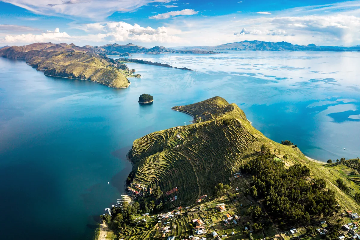
Where Is Lake Titicaca?
Lake Titicaca lies in southeastern Peru and western Bolivia, between the regions of Puno and La Paz, respectively. It sits at approximately 3,812 meters (12,507 feet) above sea level and stretches across a vast basin covering much of the Andean Altiplano.
The lake occupies a geographical area at roughly the same latitude as Brasília, the capital of Brazil. Titicaca Lake extends between 68°33′ and 70°02′ west longitude and between 15°13′ and 16°35′ south latitude.
Map of Lake Titicaca
How to Get to Lake Titicaca
Reaching Titicaca Lake is relatively easy. Your journey may include a flight, but the final stage is always completed by road, followed by a boat trip across the lake. Several routes provide access from both the Peruvian and Bolivian sides.
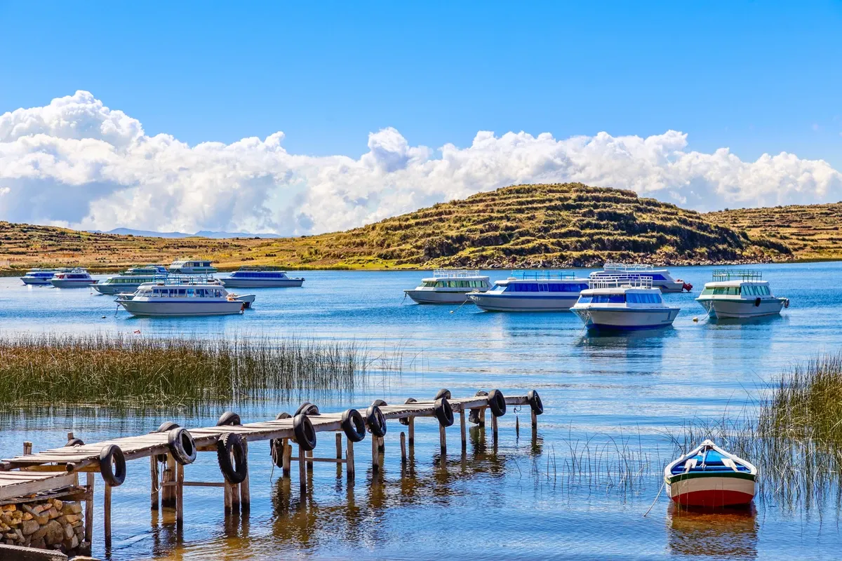
Traveling from Peru
To reach Lake Titicaca from the Peruvian side, you must first travel to Puno, the main gateway to the lake and the departure point for boats exploring the area and visiting the Uros, Taquile, and Amantaní islands. The most common routes are:
By air | Lima - Juliaca - Puno
The fastest option is to fly from Lima to Juliaca. The flight takes approximately 1 hour and 40 minutes. From Juliaca Airport, the drive to the city of Puno takes less than one hour.
By road | Lima - Puno
The bus journey from Lima to Puno usually takes between 20 and 23 hours. It is a long route, so choosing a comfortable service and traveling overnight whenever possible is recommended.
By road | Cusco - Puno
Traveling from Cusco to Puno is a popular option for visitors exploring southern Peru. The direct bus journey takes approximately seven hours.
You can also take the famous Route of the Sun, a longer 10-hour tourist journey connecting Cusco and Puno. Along the way, it stops at important archaeological sites, museums, churches, traditional villages, and places where you can sample Peruvian cuisine.
By road | Arequipa - Puno
The direct journey from Arequipa to Puno usually takes around six hours.
Another option is the tourist route connecting the Colca Canyon with Puno. The journey takes approximately six hours and includes stops between Chivay and Puno, offering opportunities to see high-Andean lagoons, small villages, local wildlife, and volcanic landscapes.
Traveling to Lake Titicaca by Train
Traveling to Puno by train is a comfortable and memorable option aboard South America’s first luxury sleeper train. The experience combines a relaxing journey with exclusive service, gourmet cuisine, and spectacular high-Andean scenery all the way to the shores of Lake Titicaca.
This remarkable journey aboard the Belmond Andean Explorer departs from Cusco and Arequipa once a week. The shorter one-night itineraries are:
- Cusco - Puno train: departs every Thursday at 11:00 a.m.
- Arequipa - Puno train: departs every Sunday.
There are also two-night itineraries connecting Cusco, Puno, and Arequipa, ideal for travelers who want a more complete journey through the Peruvian Andes.
Traveling from Bolivia
To reach Lake Titicaca from the Bolivian side, you must first travel to Copacabana, the main gateway to the lake and the departure point for boat trips to the famous Island of the Sun and Island of the Moon. Copacabana is located approximately 155 km from La Paz.
The most common routes are:
By air | El Alto Airport–Copacabana
The closest international airport to Titicaca Lake in Bolivia is El Alto International Airport, which receives both domestic and international flights. From there, the journey continues by road to Copacabana and usually takes between 3 hours and 30 minutes and 4 hours.
Travel time may vary depending on traffic and the wait required to cross the Strait of Tiquina, where passengers and vehicles cross a narrow section of the lake on separate boats.
By road | La Paz–Copacabana
Traveling by road from La Paz to Copacabana is the most popular option. The journey usually takes around four hours and includes crossing the Strait of Tiquina.
You can make the journey by tourist bus, public transportation, or private vehicle. Before traveling, confirm the departure point, schedule, and service conditions, as these may vary depending on the company and season.
Boat trips to the islands of Lake Titicaca usually depart from the docks in Puno and Copacabana. Tours range from half-day excursions to three-day journeys with overnight stays on the islands.
Protection and Conservation of Lake Titicaca
Lake Titicaca covers approximately 850,000 hectares in total. It stretches 190 kilometers from northeast to southeast and reaches a maximum width of 80 kilometers. Over time, the lake has become the focus of several conservation efforts because of its exceptional biological and environmental importance. The main measures include:
- In 1978, the Titicaca National Reserve was established in Peru. Now managed by Peru’s National Service of Natural Areas Protected by the State (SERNANP), the reserve protects 36,180 hectares of the lake across two separate areas: the Ramis sector in Huancané Province and the Puno sector in the province of the same name.
In 1996, the Binational Autonomous Authority of Titicaca Lake(ALT) was created. This organization is linked to the foreign affairs ministries of Peru and Bolivia and protects 14,525 hectares.
Its main purpose is to support the management of water and aquatic resources in lakes Titicaca, Uru Uru, and Poopó, promote the responsible use of their natural resources, and strengthen cooperation between both countries.
- In 1997, Lake Titicaca was designated a Ramsar Site, or Wetland of International Importance, because of its exceptional biodiversity and its strategic role as a habitat, refuge, and migration stop for numerous wildlife species. The area protected under this designation covers approximately 36,000 hectares.
- In 2005, the Tourism Use Plan for the Titicaca National Reserve was developed to encourage the sustainable use of the protected area and guide tourism and recreational activities within the lake.
Ramsar Convention
The Ramsar Convention is an intergovernmental treaty that recognizes the international importance of selected freshwater and saltwater ecosystems. These wetlands play an essential role in conserving biodiversity, regulating water systems, and supporting numerous communities. Peru has 13 sites recognized under this designation.
History of Lake Titicaca
The history of Lake Titicaca began approximately three million years ago. Since then, its landscape has changed constantly due to geological movements, glaciations, and climate variations that transformed the Andes.
- During the Pleistocene, Titicaca formed part of a vast prehistoric lake system known as Mataro, which covered large areas of what are now Peru and Bolivia. Over time, several paleolakes emerged, including Cabana, Ballivián, Minchin, and Tauca. Between 2,000 and 1,000 years ago, the lake began to take on its present shape, with the Desaguadero River serving as its outlet.
- The human history of Titicaca Lake is equally ancient and fascinating. Its shores and islands have been inhabited for thousands of years by different Andean societies, from the Chiripa and Pukara cultures to the great Tiwanaku, or Tiahuanaco, civilization, which flourished before the rise of the Inca Empire.
- The coexistence and exchange between these peoples left an important cultural and religious legacy around the lake. Their main ceremonial centers included the Island of the Sun, the Island of the Moon, and the Kalasasaya site on the Bolivian side. These places served as sacred spaces and pilgrimage centers. Their importance continued throughout the reigns of the Inca emperors, when Lake Titicaca became central to the Inca worldview and their stories of origin.
Flora and Fauna of Lake Titicaca
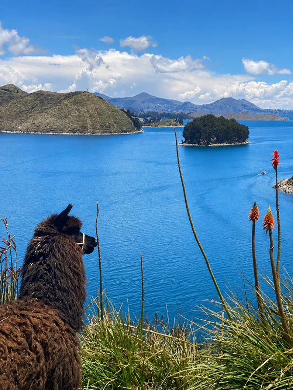
The lake’s surroundings have unique ecosystem characteristics and are home to approximately 159 animal species and 171 plant species. The main recorded groups include:
- 15 species of mammals.
- 105 species of birds.
- 9 species of amphibians.
- 4 species of reptiles.
The lake is also home to more than 26 fish species that have adapted to its extreme conditions. These include bony fish from the Orestias genus and two species from the Trichomycterus genus, locally known as suche or puna catfish.
 |  |
Titicaca Water Frog
Among the lake’s amphibians, the frogs belonging to the Telmatobius genus are particularly remarkable. An estimated 18 species from this genus are native to the Lake Titicaca region.
These animals have a distinctive appearance, with dark or greenish coloring and loose skin covered in highly vascularized folds. This adaptation increases the surface area in contact with the water, allowing them to absorb oxygen through their skin more efficiently.
Birdwatching at Lake Titicaca
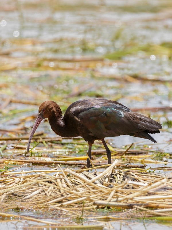
Titicaca Lake is an excellent destination for spotting high-Andean birds. The greatest concentration of species can be found along the shoreline, in shallow bays, and among the extensive totora reed beds in areas such as Puno, Ramis, and Achacachi, where birds find abundant food and shelter.
Visitors may see puna ibises, Andean geese, Chilean flamingos, Andean gulls, cormorants, great egrets, coots, and several duck species, including puna teals, yellow-billed pintails, and cinnamon teals. One of the lake’s most iconic and difficult birds to spot is the Titicaca grebe, an endemic species specially adapted to the lake’s waters.
The Origin of the Incas and Lake Titicaca
The landscapes of Lake Titicaca have inspired countless myths and legends among the peoples who lived along its shores. One of the best-known stories explains the origin of the Incas and the founding of Cusco.
The Legend of Manco Cápac and Mama Ocllo
This story was recorded by Inca Garcilaso de la Vega, a mestizo writer and the son of the Inca princess Chimpu Ocllo. According to his chronicles, his mother’s relatives passed down to him the story of Manco Cápac and Mama Ocllo, who were believed to be the children of the Sun God.
The legend tells that, in ancient times, human beings lived without laws, authorities, or the knowledge needed to cultivate the land and raise animals. Seeing this, the Sun God took pity on them and sent one of his sons and one of his daughters with the mission of teaching them how to live in community, work the land, and worship the Sun.
Before they departed, he gave them a golden staff and told them to travel until they found the place where it would sink completely into the ground. There, they would establish their rule and found the great Empire of the Sun.
In this way, Manco Cápac and Mama Ocllo emerged from the waters of Titicaca Lake and began their journey north. After traveling through different lands, they arrived in the Cusco Valley, where the golden staff finally sank into the earth. According to tradition, this was the chosen place to found the capital of the future Inca Empire.
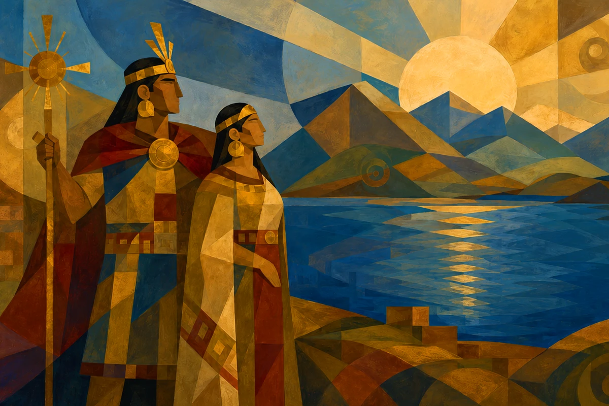
Every November 4, during the anniversary of Puno, the legend of Manco Cápac and Mama Ocllo is reenacted on Lake Titicaca.
Geography of Titicaca Lake
Lake Titicaca stretches across the Andean Altiplano between Peru and Bolivia, surrounded by impressive mountains and vast plains that create one of the most distinctive landscapes in the Americas.
The Western Cordillera of the Andes, which extends northward from Chile, and the Eastern Cordillera, which rises from Bolivia, surround the lake. These two mountain ranges meet farther north in Peru, forming the Vilcanota Mountain Junction in the Cusco region.
Hydrologically, Titicaca belongs to an endorheic basin. This means that its waters do not flow into the ocean but remain within the basin, feeding other lakes and even salt flats.
More than 25 rivers flow into Titicaca Lake. The most important is Peru’s Ramis River, which supplies nearly two-fifths of the water entering the lake. Its only surface outlet is the Desaguadero River, located near the border between Peru and Bolivia. However, only about 5% of the lake’s water leaves through this channel. Most of it is lost through evaporation, encouraged by intense sunlight, strong winds, and the Altiplano’s climate.
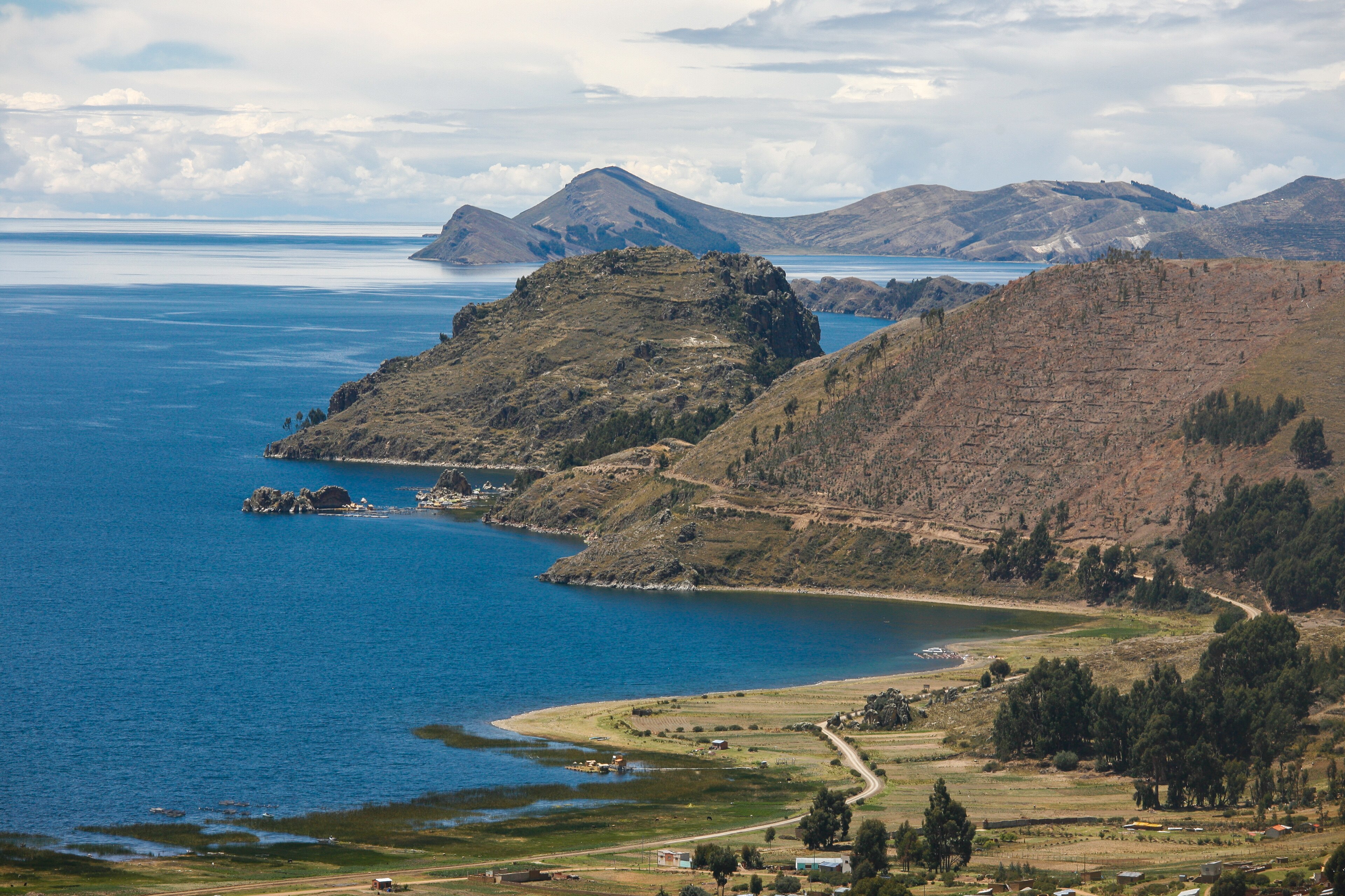
How Deep Is Lake Titicaca?
The average depth of Lake Titicaca ranges from 140 to 180 meters, while its maximum depth is approximately 280 meters, or 930 feet, near Soto Island in the northeastern part of the lake.
Landscape and Islands of Lake Titicaca
Surrounding Area of Lake Titicaca
The vast plains surrounding Lake Titicaca lie between 3,820 and 3,950 meters above sea level. This landscape is typical of the high-Andean steppe, where hardy ichu grass, also known as paja brava, dominates the scenery.
Native species such as queñua, taya, mutuy, cantu, and huamanpinta also grow in the surrounding area, along with some introduced species such as eucalyptus.
Islands of Lake Titicaca
Lake Titicaca is home to more than one hundred islands and islets, spread across Peru and Bolivia. Some are natural formations, while others were built by local communities using techniques passed down through generations. Among the most important inhabited natural islands are:
Islands on the Peruvian side
- Amantaní Island: has an approximate area of 9.28 km².
- Taquile or Intika Island: covers around 5.72 km².
Islands on the Bolivian side
- Island of the Sun is the largest island in Titicaca Lake, with an approximate area of 14.3 km².
- Island of the Moon or Koati has an area of about 2 km².
Artificial Islands on Lake Titicaca
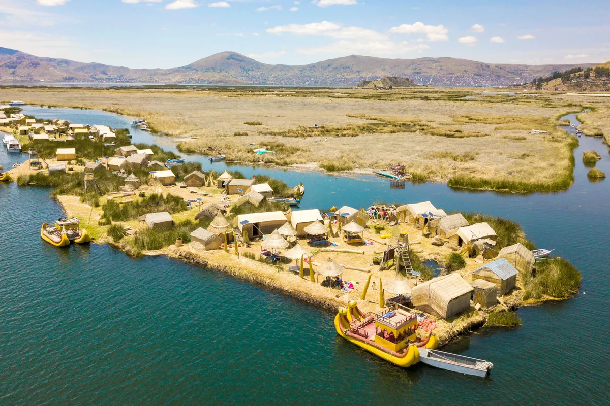
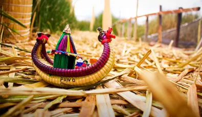
One of the most remarkable cultural landscapes of Lake Titicaca is its floating islands. These structures are handmade from totora, a native aquatic plant of the lake, using knowledge that has been passed down from one generation to the next.
It is estimated that there are more than 150 floating islands. Each one belongs to a family or community, and its size can change over time. Several families may join their platforms to create a larger island or separate them to form new living spaces.
- On the Peruvian side, the best-known totora islands are the floating islands of Uros, Chulluni, and Chimu.
- In Bolivia, one of the most well-known is Pachakamak, which belongs to the Uru Irohito community. Chisawa, Phuwa, and Inti Huata are also found there.
What to Do at Lake Titicaca
There are many reasons to visit Lake Titicaca. Sailing across its waters is an unforgettable experience and an opportunity to connect with nature, history, and the Indigenous communities of the region.
The main activity is exploring the lake by boat, with full-day excursions and trips lasting two or more days that include overnight stays on islands such as Taquile or Amantaní. During these visits, travelers can enjoy community-based tourism and meet local families who share their traditions, daily activities, and way of life closely connected to the lake.
Several islands also offer hiking trails, panoramic views, and archaeological sites that preserve traces of the region’s ancient cultures.
Although less common, the lake also offers water and adventure activities such as kayaking and recreational diving.
Uros Floating Islands
The floating islands inhabited by the Uros community are among the main attractions on the Peruvian side of Titicaca Lake. The Uros are one of the oldest cultures in the Americas, with origins dating back long before the Incas.
They call themselves the “people of the water” and traditionally depend on fishing and hunting for much of their livelihood. Today, their main activities include fishing, hunting, textile art, and tourism.
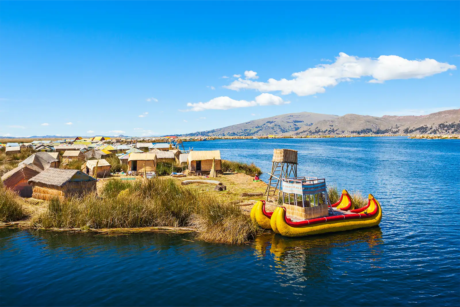
Beyond their beauty and the distinctive lifestyle of their residents, these islands are remarkable for the techniques used to build them. Totora reeds grow in the shallower waters of Lake Titicaca and are woven together to form these extraordinary islands. They are made from many layers of totora, which must continually be replaced from the top.
Taquile Island
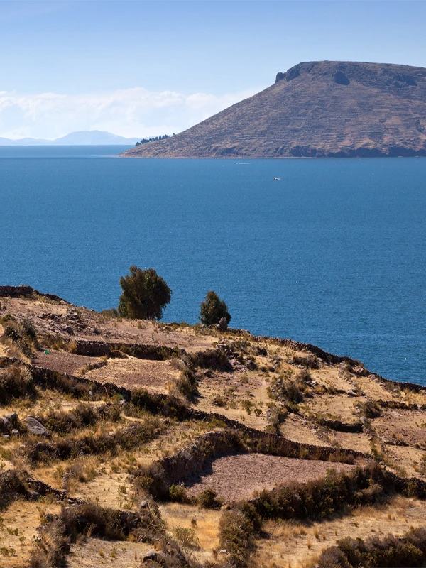
This small island on the Peruvian side, home to around 2,200 people, is known for its beautiful scenery and rich traditions. Its highest point reaches 4,050 meters above sea level and offers sweeping views of Lake Titicaca, the nearby islands, and even the snowcapped mountains surrounding the Altiplano.
Many of its hillsides are still used for farming through ancient pre-Inca and Inca terraces, which remain an important part of Taquile’s landscape.
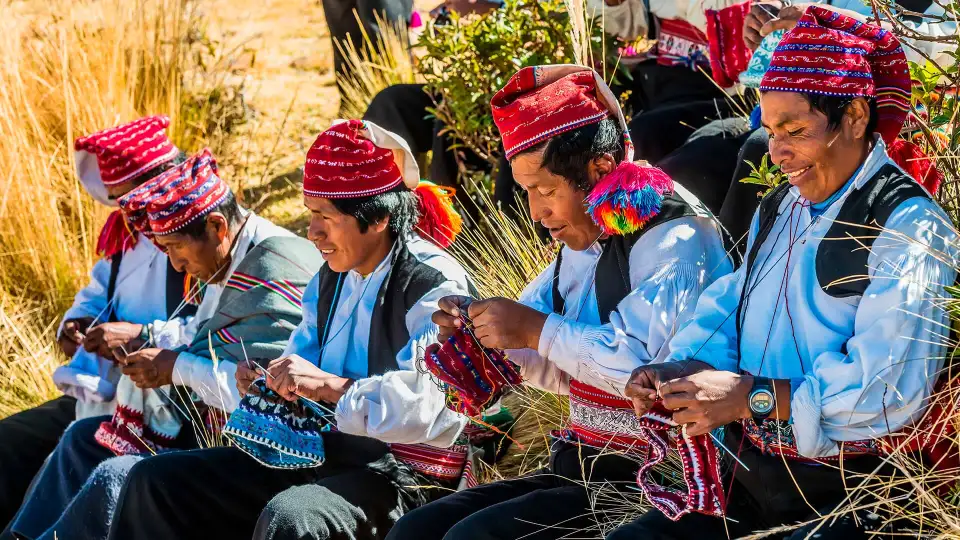
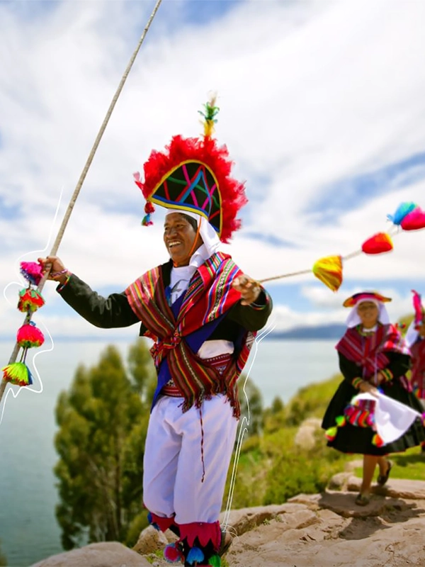
One of the island’s greatest attractions is the cultural identity its residents have preserved and passed down through generations. This heritage is expressed through music, songs, celebrations, and especially its distinctive textile tradition, admired for the quality, symbolism, and skill behind every piece.
 | |
 |  |
Read next | Things to Do in Puno: Activities and Places for Your Next Trip
Amantaní Island
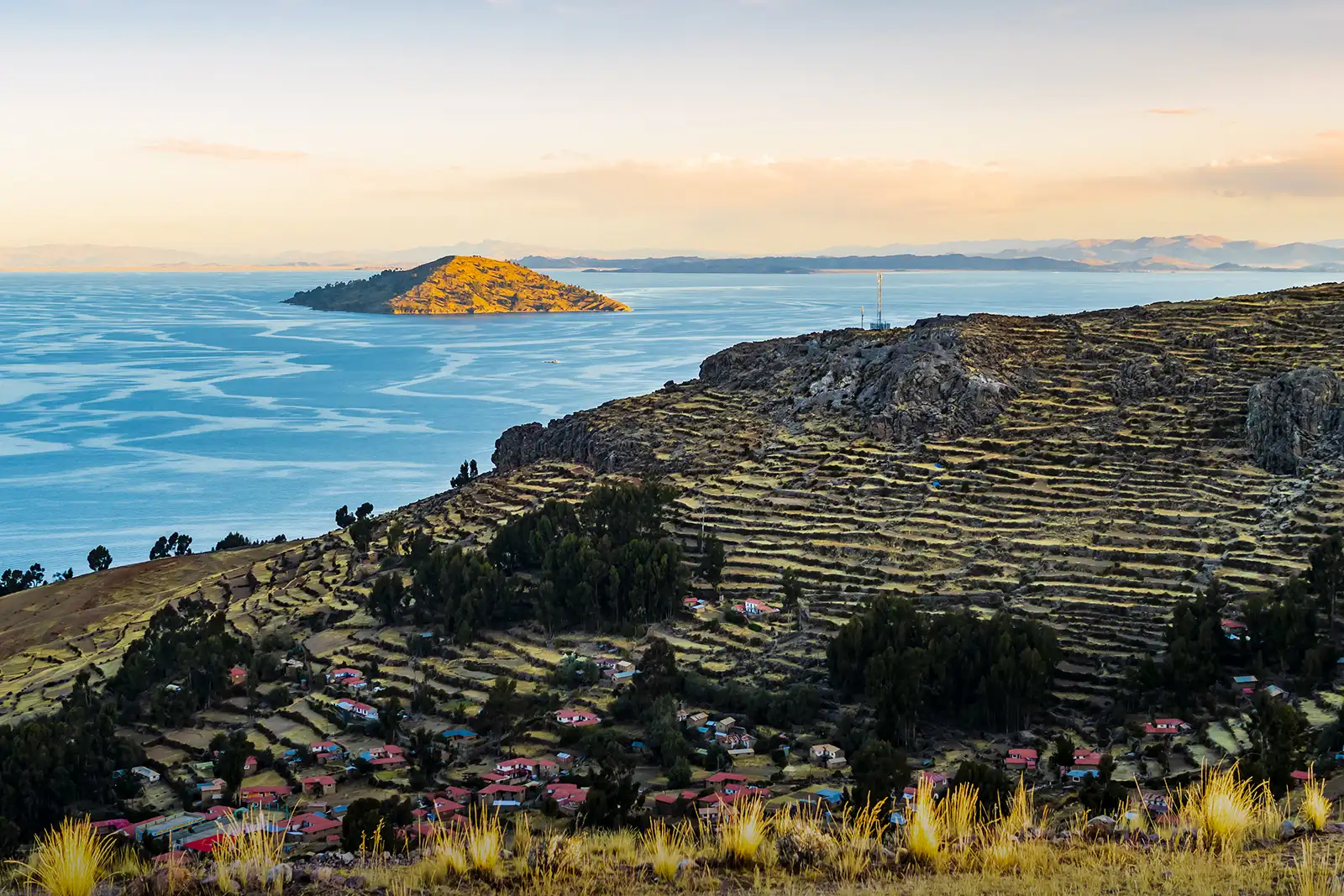
Amantaní Island lies just a few kilometers from Taquile on the Peruvian side of the lake. Although it welcomes visitors throughout the year, it has preserved its peaceful landscapes and traditional character. One of the best ways to explore the island is to follow its trails to the Pachamama and Pachatata ceremonial sites, located on its highest hills. From there, you can enjoy sweeping views of Lake Titicaca, especially at sunset.
Amantaní also offers one of the lake’s most authentic cultural experiences. Travelers can spend the night in a local family’s home and learn about daily life on the island. The stay often includes community activities during which residents share their stories, customs, and knowledge of textile making, agriculture, and animal husbandry.
Island of the Sun
The Island of the Sun is one of the most important destinations on the Bolivian side of Lake Titicaca. You can explore it on foot, admire its landscapes, visit the archaeological site dedicated to this Inca god, and meet families living in its communities. Spending the night on the island is also possible and gives you more time to explore at a relaxed pace while enjoying sunrise or sunset over the lake.
Island of the Moon
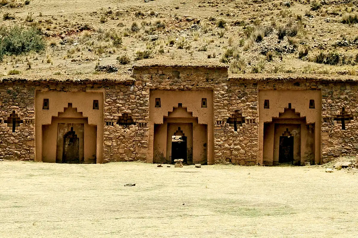
Smaller and quieter than the Island of the Sun, the Island of the Moon is known for the Iñak Uyu archaeological complex. This pre-Hispanic site was associated with the acllawasi, or House of the Chosen Women, where selected women performed religious duties such as preparing chicha or aqa, along with other rituals connected to the worship of the Sun during the Inca period.
Both islands are commonly visited on boat tours departing from Copacabana, Bolivia.
Best Time to Visit Lake Titicaca
The best time to visit Lake Titicaca is from May to September, during the dry season. This period offers the most favorable conditions for exploring the lake and visiting its islands.
Dry Season (May to September)
This season is known for sunny days, clear skies, and little rainfall, creating ideal conditions for boat trips, island visits, and hiking.
- Sunny mornings: temperatures usually range from 14°C to 17°C. Because of the high altitude, the sun can feel intense, especially when there is little wind.
- Cold nights: temperatures fall quickly after sunset. Between June and August, they may reach 0°C or drop as low as –4°C, especially in July, the coldest month of the year.
Rainy Season (November to March)
As its name suggests, this season brings more frequent rainfall, with January and February usually receiving the heaviest rain.
- Mild mornings: mornings are often clear, with rain developing later in the afternoon or during the night.
- Rainy-season temperatures: daytime temperatures usually remain between 15°C and 17°C, while nighttime temperatures generally range from 4°C to 6°C.
April, October, and November are transitional months. They often bring pleasant temperatures, fewer visitors, and colorful landscapes, although occasional rain is still possible.
Important: rain may affect some boat schedules and make certain trails wet or slippery.
Tips for Visiting Lake Titicaca
Keep these tips in mind for a safer and more comfortable visit to Lake Titicaca:
- Acclimatize gradually. Spend at least one day in Puno or Cusco before joining any excursions. This can help reduce the risk of soroche, or altitude sickness.
- Bring warm clothing and dress in layers. Temperatures can change quickly, especially at sunrise, after sunset, and during boat tours.
- Pack protection from rain and wind. A waterproof poncho and windproof jacket are useful even during the dry season.
- Protect your hands, head, and neck. Bring a warm hat, gloves, and scarf for the coldest hours of the day.
- Stay well hydrated. Drink water regularly, even when you do not feel thirsty.
- Avoid alcohol and tobacco. Both can make it harder for your body to adjust to the altitude and may cause dizziness during boat trips.
- Choose light, nutritious meals. Avoid heavy foods and select options that provide energy without being difficult to digest. You can also try coca tea, which may support acclimatization and digestion.
- Walk at a comfortable pace. Avoid rushing and take breaks whenever necessary, especially during your first few days.
Titicaca Lake brings together nature, history, and living culture in a landscape that is difficult to fully appreciate from the shore alone. Sailing between its islands, speaking with local residents, and admiring the vast lake from its viewpoints reveal a different side of the Andes.
Now that you know more about this great sacred lake, all that remains is deciding how you would like to experience it. We can help you plan a journey that suits your available time, interests, and travel style.
Lake Titicaca FAQs
What does Titicaca mean?
The name Titicaca is believed to come from the Quechua words titi, meaning “Andean cat,” and qaqa, meaning “rock” or “cliff.” Together, they can be interpreted as “Rock of the Andean Cat.”
However, the name may also have roots in Puquina, an ancient language that is now extinct. Its original meaning may have been “Rock of the Sun,” referring either to the Island of the Sun or to the symbolic connection between the titi feline and the Sun.
Some colonial chronicles also refer to Titicaca as the “Lagoon of Poquina,” possibly because Puquina-speaking communities once lived around the lake.
How many days do you need to visit Lake Titicaca?
For a first visit, plan to spend at least one day. A full-day tour usually includes the Uros Floating Islands and, depending on the itinerary, Taquile Island. With two or three days, you can also visit Amantaní, stay overnight with a local family, and explore the lake at a more relaxed pace.
Is it better to visit Lake Titicaca from Puno or Copacabana?
It depends on which places you want to visit. Puno is the main departure point for the Uros, Taquile, and Amantaní islands on the Peruvian side. Copacabana is the most popular base for visiting the Island of the Sun and the Island of the Moon in Bolivia. Both sides offer different landscapes, archaeological sites, and cultural experiences.
When traveling through Peru, Puno is one of the country’s most visited destinations, along with Arequipa, Lima, and Cusco. You can therefore find Peru tour packages that include Lake Titicaca.
Can you pay by card on the islands of Lake Titicaca?
Cash is the main form of payment on many islands, in local communities, and at small businesses. Electronic payment connections may be limited, so it is best to carry Peruvian soles on the Peruvian side and bolivianos on the Bolivian side, especially when buying food, handicrafts, or local services.
Is there phone and internet service on the islands?
Mobile coverage varies depending on the island, phone provider, and weather conditions. Some areas closer to Puno or Copacabana may have service, but connections are often weak or unreliable in more remote locations. Download maps, booking details, and important documents before beginning your trip.
What languages are spoken in the communities around Lake Titicaca?
Spanish, Quechua, and Aymara are the main languages spoken in the communities around the lake. The most widely used language varies depending on the area and community you visit. On organized tours, guides commonly provide explanations in Spanish and English.

Add new comment